Randonnée Marche La Vieille-Lyre - champignolles 14 octobre 2016 - Photo

champignolles 14 octobre 2016

 dominiquelaudou
dominiquelaudou

Utilisateur

© OpenStreetMap contributors
Longueur
Longueur
8,3 km
Altitude max
Altitude max
185 m
Dénivelé positif
Dénivelé positif
134 m
Km-Effort
Km-Effort  
10,1 km
Altitude min
Altitude min
131 m
Dénivelé négatif
Dénivelé négatif
134 m
Boucle
Boucle
Oui
Date de création :
2016-10-08 00:00:00.0
Dernière modification :
2016-10-08 00:00:00.0

(0 Avis)

Marche
Marche
2h12
Difficulté : Facile

Scannez ce code QR pour ouvrir la randonnée dans l'application SityTrail

Application GPS de randonnée GRATUITE

Logo SityTrail SityTrail

IGN / Instituts géographiques

Télécharger SityTrail sur l'App Store Télécharger SityTrail sur Google Play

Logo SityTrail SityTrail World

Le monde est à vous

Télécharger SityTrail sur l'App Store Télécharger SityTrail sur Google Play Télécharger SityTrail sur Huawei AppGallery

À propos

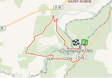
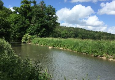
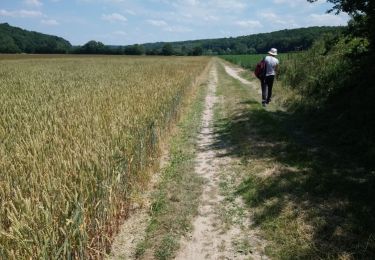
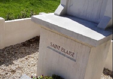
Randonnée Marche de 8,3 km à découvrir à Normandie, Eure, La Vieille-Lyre. Cette randonnée est proposée par dominiquelaudou.

Description

la sente à gilbert,
rubremont,le petit harcourt

Profil altimétrique

Localisation

Pays :
France
Région :
Normandie
Département/Province :
Eure
Commune :
La Vieille-Lyre
Localité :
Unknown
Départ:(Dec)
Départ:(UTM)
336200 ; 5424904 (31U) N.

Randonnées à proximité

Randonnée Marche La Vieille-Lyre - 20220608-Champignoles - Photo
Marche
doudet

Marche

Moyen
La Vieille-Lyre, Normandie, Eure, France
18,5 km | 21 km-effort
5h 3min
Oui
Randonnée Marche La Houssaye - Circuit des Moulins - La Houssaye - Photo
Marche
tracegps

Marche

Difficile
(2)
La Houssaye, Normandie, Eure, France
12,3 km | 14,4 km-effort
3h 4min
Oui
Randonnée V.T.T. Mesnil-en-Ouche - Circuit de la Pinçonniére - Bosc - Renoult-en-Ouche - Photo
V.T.T.
tracegps

V.T.T.

Facile
Mesnil-en-Ouche, Normandie, Eure, France
7,7 km | 8,4 km-effort
1h 0min
Oui
Randonnée Marche Mesnil-en-Ouche - Circuit de la Pinçonniére - Bosc - Renoult-en-Ouche - Photo
Marche
tracegps

Marche

Moyen
Mesnil-en-Ouche, Normandie, Eure, France
7,7 km | 8,4 km-effort
2h 0min
Oui
Randonnée Marche La Ferrière-sur-Risle - Ajou - Photo
Marche
serleb

Marche

La Ferrière-sur-Risle, Normandie, Eure, France
9,4 km | 10,7 km-effort
2h 34min
Oui
Randonnée Marche Mesnil-en-Ouche - Ajou - Photo
Marche
werth

Marche

Facile
Mesnil-en-Ouche, Normandie, Eure, France
14,3 km | 16,9 km-effort
5h 1min
Oui
Randonnée Marche La Ferrière-sur-Risle - Ferrieres entre risle et colombages - Photo
Marche
ymarvin27

Marche

Facile
(1)
La Ferrière-sur-Risle, Normandie, Eure, France
7,7 km | 9,1 km-effort
1h 47min
Oui
Randonnée Marche La Ferrière-sur-Risle - ajou  la ferriere 31 mars 2017 - Photo
Marche
dominiquelaudou

Marche

Facile
La Ferrière-sur-Risle, Normandie, Eure, France
8,7 km | 10,1 km-effort
2h 14min
Oui
Randonnée Marche Mesnil-en-Ouche - bosc renoult en ouche 9 octobre 2016 - Photo
Marche
dominiquelaudou

Marche

Facile
Mesnil-en-Ouche, Normandie, Eure, France
8,6 km | 9,8 km-effort
2h 8min
Oui


Fermer
Mes abonnements